I hope you liked the mid 90s Chumbawamba reference in the title and it doesnt leave the song stuck in your head for hours like it did me! We have had some of the highest and lowest moments on the trail these last 5 days. We try to keep it mostly positive on the blog, but some days the hiking is just hard! Here is a recap of our last few days on the trail:
Day 52 (5/28)
Starting: Lane St., Pearisburg, VA, 631.3
Ending: Pine Swamp Shelter, 650.6
Total Miles: 19.3
After pulling Mike away from the Holiday Motor Lodge we went to Dairy Queen for breakfast before we hit the trail. It apparently had the best breakfast in town so we knew we couldnt miss it! After breakfast we took the rental car back to Enterprise and were dropped back off at the trail head. We had a small section of trail to do before the road crossed Pearisburg again (about .75 miles). During that section, I fell twice. The first fall I slipped on a rock and fell right on my tailbone. It was very similar to a fall I had taken a few weeks ago on our way into the NOC and it made me cry. I was mainly crying due to frustration and the fact that I didnt want to be dealing with extreme back pain again. It took a few minutes for me to compose myself and get back up. In less than five minutes, I fell again. This time, I slipped on loose dirt going down a hill and the weight of my pack caused me to fall over on my side. I was angry and ready to be done with this section of the trail! About 100 yards after my second fall, we crossed back into Pearisburg and right beside the rental car company. In retrospect, I would have been happy to skip that section of trail all together and start from the rental car parking lot!
Luckily, the rest of the day was much more uneventful. The trail out of Pearisburg kept winding us through the outskirts of town and we got to take in the very industrial side of the town. This included a Chemical Plant and a landfill! We decided we wouldnt be getting water from any of the streams on this section of the trail!

We got to camp right before dark and had dinner with a section hiker from New Hampshire called Slow Going. He was a trail veteran and it was nice to hear his stories about the trail. We had to set up the tent in the dark and it was the first time I got to use my headlamp!
I was happy to put this day behind me and start over again tomorrow.
Day 53
Starting: Pine Swamp Shelter, 650.6
Ending: Laurel Creek Shelter: 669.1
Total Miles: 18.5
Today was another day that we were extremely happy to see the shelter at the end of the day. We got an early start on the trail and had a pretty uneventful morning. We had two big climbs to do before lunch and saw our first turtle!
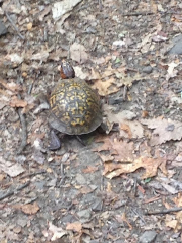
I was hoping the turtle would be the most eventful thing that happened to us on the trail, but that wasnt the case.
The weather had been overcast all day and we knew there were storms in the forecast. We took a break around 4pm at a campground to get water and stretch. The sky was getting dark and I was afraid it was getting ready to start storming. We still had six miles to get to our shelter for the night. We had to be in Daleville by Sunday so we knew we had to keep going. About 4 miles away from the shelter the storm came! The thunder was very loud and the lightning strikes were a lot closer than I would have liked. We were on a section of the trail where there really wasnt a spot to stop. We were on a ridge of a mountain so we knew we just had to keep going to the shelter. We were practically running to the shelter. The trail quickly became a stream with water about 3 inches deep. It was a very scary experience and again, I was ready to be done with the day! The storm stopped and the sky cleard when we were about 1 mile away from the shelter. We were able to calm down and do the last mile in at a normal speed.
We fixed dinner and went to bed happy to dry and safe!
Day 54
Starting:Laurel Creek Shelter: 669.1
Ending: Trout Creek Campsite: 690.4
Total Miles: 21.3
We knew we had some big miles to put in today so we tried to get out of camp quickly. Our clothes and shoes were still soaked from the storm the day before so we started out the morning a little soggy. The first half of the day was some of the most difficult terrain we have had to deal with on the trai. We were excited to see the profile of this section was mostly flat. However, that flat trail was covered with rocks and roots that were still wet from the rain the previous day. It made for some slow progress and more falls on the part of Mike and myself.
We covered 12 miles in about 7 hours and didnt make it to the shelter for lunch until 2:30. We were extremely frustrated and started trying to figure out if it was at all possible to end the day at that shelter and still make it to Daleville by Sunday. We decided we should just push on and try to finish off the crappy day on a high note.
Luckily, most of the rocks went away for the second half of the day and most of our hiking was on relatively nice trail. We made up for our slow going and covered 9 miles in about 3 hours. I think we were both happy to finally be making progress. We ended up stopping short of our intended shelter by about 1 mile. We came across a campsite right by a river that was too nice to pass up. We set up camp and went to bed early. This was another day that we were both happy was over!
Day 55
Starting:Trout Creek Campsite: 690.4
Ending: Pig Farm Campsite: 708.5
Total Miles: 18.1
Today was a nice change from our previous days. We crossed two of the most visited spots on the AT; Dragon's Tooth and McAfee Knob. They are very popular because of the amazing views they offer of the Catawba Valley. It was still a little overcast and foggy when we started off the hike. I was hoping by the time we reached Dragon's Tooth the sun would be out so we could see the views. Luckily, when we were about a mile out the sun came out and we were able to see the valley clearly.
On the way down the trail after Dragon's Tooth the climbing became very steep and technical. This was the first time we had to use rungs in the side of the rocks to get down. We had to drop our hiking poles and use our hands and feet to traverse the trail. We kept saying that this would be a good preview of some of the trail in the northern states.


After Dragon's Tooth we planned to have lunch at a gas station/convenience store located about .3 miles off the trail. We were planning on just getting a soda and maybe a few snacks to eat with our lunch. When we got there we found out they had a grill and ice cream! Our plans of eating our tortillas and tuna fish quickly went out the door. Mike's lunch consisted of the following: cheeseburger, slice of pizza, half bag of sour cream and onion chips, twinkie, mini peanut butter pie, 3/4 pint of ice cream, zone perfect bar, V8 (to be healthy), and a starbucks iced coffee. I think we spent almost an hour outside the gas station eating. Mike said in the future whenever he goes to pump gas he will always feel the need to go in and eat a cheeseburger as well.
Once we were completely stuffed on food we got back on the trail to finish the 10 miles we still had to do to get us to the campsite. We were excited because we knew we would be getting to see McAfee Knob soon.
The climb to the top of the knob was a lot easier than Dragon's Tooth. We were getting toward the end of the day so the traffic on the trail had died down. We were able to get to the top relatively quickly and enjoyed the view from the knob with a few other people. Luckily, someone offered to take a picture of us. We usually have to resort to selfies when we want a picture with both of us in it. The views were amazing and the weather was perfect.


Today definitely helped lift our spirits and remind us why we decided to go on this crazy adventure in the first place!
Day 56
Starting: Pig Farm Campsite: 708.5
Ending: Daleville, VA: 724.0
Total Miles: 15.5
When we have the promise of a hotel and real food at the end of the day we always move fast getting out of camp in the morning. Today was no exception, we were able to get out of camp before 8am. Although, another group of people we were camping with left the campsite at 4:45am to hike back up to McAfee knob to watch the sunrise. We weren't that motivated to get up.
About 2 hours into the hike we crossed Tinker Cliffs. This was another spot along the trail that had some great views. We took a few minutes to enjoy the view and take some picutres. Then we were back on the trail with tunnel vision to town! We heard there was a great bbq restaurant and that kept us motivated to finish quickly.


We got into town around 2:30 and headed straight to the restaurant. The restaurant didn't dissapoint and we were stuffed and happy in no time. We headed back to the hotel and met up with James and Barbara Evans, our hiking partners for the next four days. We are very excited to have some friends on the trail. James and Barbara have both spent a lot of time on the AT so I am excited to spend time with them during this time.
We are planning on ending our trip near the James River on Thursday.
Happy Trails,
Z and G
Here's to no more falls this week!!!! The views look amazing! Hang in there!
ReplyDeleteI just looked on google maps how far yall have gone and I'm pretty sure its longer than I've ran in my entire life combined, y'all are awesome. The gas station food story is my favorite, and in Mike's defense, I feel like that every time I go to a gas station despite the fact that I haven't hiked the AT. Enjoy the sights
ReplyDeleteBacktracking to McAfee Knob was well worth it for us. If you hadn't suggested it, we would have missed it. A fitting final hike to 4 days of an enjoyable trip.
ReplyDelete